| Student: | |
|---|---|
| Timeline: | December 2013 - 1 December 2020 |
In urban areas, natural surfaces (e.g. grass, crops, and soil) are replaced with impervious built-up surfaces (e.g. concrete, asphalt), changing the land surface thermal and radiative properties as well as surface roughness in comparison with rural areas. This leads to modifications of the surface energy balance, which governs the momentum, heat and mass transfer between the surface and the atmosphere, thus impacts dynamic processes in the Urban Boundary Layer, and ultimately influences the local, regional and even global climate. Given the increasing urban population, rapid urban sprawl, and the more frequent occurrence of heat waves, studying the surface energy budget over urban areas and its relationship with urbanization is imperative.

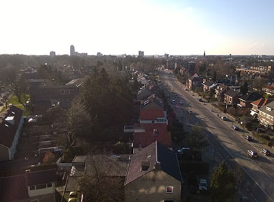
Figure 1 Photographic view from the roof of Esmarke building
The overall object of this project is to estimate the urban surface energy balance using ground and spaceborne remote sensing measurements combined with meteorological observations. This project will focus on urban materials and 3D geometry induced influence on city climate.

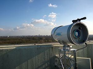
Figure 2 XLAS Receiver at Horst Building on UT Campus
An observation network will be set up in Enschede, including a thermal camera, an eddy covariance system, an extra large aperture scintillometer (XLAS), radiometers, rain gauges, a sonic anemometer and temperature profile measurements, aiming at getting a better knowledge of the surface-atmosphere interaction processes over urban areas.
Different retrieval methods of aerodynamic properties from surface morphology will be evaluated with the aid of high-resolution LiDAR DEM. Following in-situ data analysis and comparison of different Surface Energy Balance (SEB) algorithms, an improved remote sensing based urban SEB model will be developed and validated over Enschede and Beijing.


