| Student: | Z. Wang |
|---|---|
| Timeline: | September 2023 - 30 September 2027 |
With climate change, disaster increases, and traffic load increase, bridges are experiencing accelerated aging and deterioration. Therefore, more bridges in the Netherlands and around the world need regular inspection and maintenance to extend sustainability and reduce the potential risks in regard to bridge damage.
Effective methods such as non-destructive evaluation (NDE) and structural health monitoring (SHM) are studied to improve structure reliability and prevent catastrophic failures. With technologies developing, Unmanned Aerial Vehicles (UAVs) arise coming along with many advanced algorithms to monitor bridges. The inspection process using UAVs is accelerated without traffic closure while also minimizing disruption to the targeted bridge structure.
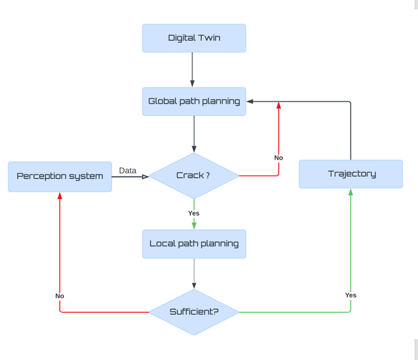
Here we focus on cracks in concrete bridges because they are part of the most common and important parameters to evaluate a bridge's serviceability. The main objective of this research is to design and execute an innovative crack-detecting Unmanned Aerial Vehicle setup for three-dimensional modelling of concrete bridges. The primary purpose is to design an active path planning of autonomous crack detection using UAV and integrate crack information into dense 3D point cloud as well as the corresponding digital twin with the aid of advanced algorithms and technologies thereby improving the maintenance and safety protocols in bridges.

Meet the team