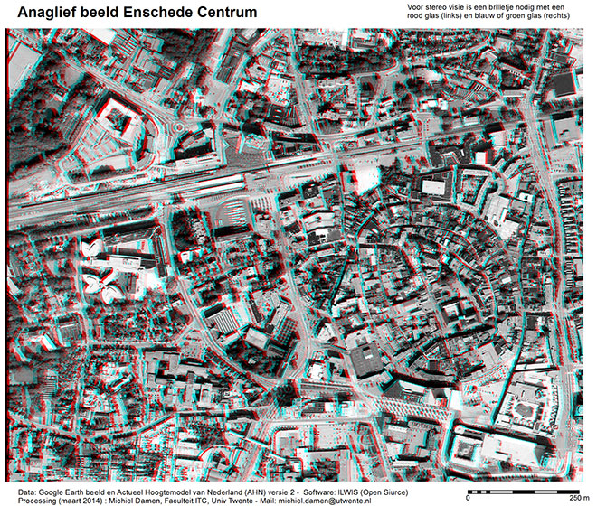
The anaglyph image is covering the central part of the city of Enschede, Netherlands, including the ITC building (northeast corner), the railway station south of ITC, the old town centre with its characteristic curved street pattern and the ITC hotel in the south. Of course you will see things better if you zoom in at details.

For stereo vision you will need 3D glasses (right eye blue and left eye red). You can easy make this yourself by instructions given by the Paper Project.
The data processing has been done by the Stereo Pair from DTM function of ITC’s ILWIS program Version 3.4. The used data are (1) a Google Earth aerial photograph of January 2005 in grey colors, and (2) a very high resolution surface model (Actual Height Model of the Netherlands, AHN2). Both data layers have been given the same geo-reference; resolution in XY direction: 50 cm; Z direction (AHN2): 1.0 cm. Light Detection And Ranging (LiDAR) is a modern remote sensing technology that measures distance by illuminating a target with a laser and analyzing the reflected light.
The AHN2 dataset has been made available to selected users by the Dutch Ministry of Infrastructure and the Environment in March 2014. It covers the topography of the Netherlands, measured by air-borne LiDAR from 2011 through 2012. With the AHN viewer you can browse yourself elevations in the Netherlands (Dutch only). In the viewer you can measure locations in Holland below sea level. Or zoom-in to the ITC building and determine in AHN2 mode the height of the rooftop relative to the parking-lot in centimeters.

