Home ITCAbout ITCScientific departmentsWater ResourcesWunder projectWorkpackagesWork package 4: Integrated WUNDER system for assessing options of agriculture and water management

Work package 4: Integrated WUNDER system for assessing options of agriculture and water management

Become a high-skilled geospatial professional

In this WP, the integrated WUNDER system (STEMMUS-SCOPE-T&C-MODFLOW) will be upscaled to national level via the discharge boundary conditions provided by the wflow_sbm model (a spatial distributed hydrological model). Furthermore, the added value of switching between the current (MetaSWAp, SWAP) and available land surface model concepts (STEMMUS-SCOPE-T&C) will be quantified. As such, this WP will apply and test the predictive capabilities of the coupled model in comparisons to what is being used currently in the Netherlands and other available concepts more applicable abroad. Use cases will be developed together with stakeholders (see WP5).
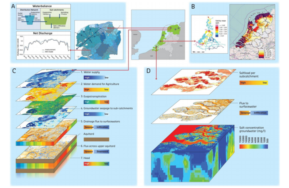
Figure 6 Overview of National Hydrological Instrument (NHI) and the STEMMUS-SCOPE Emulator is expected to contribute to the further development of NHI.

Cookies on utwente.nl

We use cookies and similar technologies and process your personal data (e.g., IP address) to personalise content and ads, to integrate media from third-party providers, or to analyse traffic. Data processing may also occur as a result of cookies being set. The data processing may take place with your consent. You have the right to withhold consent and to change or revoke your consent at a later time. For more information on the use of your data, please visit our privacy statement or cookie policy.