Home ITCAbout ITCScientific departmentsWater ResourcesWork PackagesWP5: Improving Distributed Catchment-Scale Ecohydrological Models Using Spatial Information (case studies)

WP5: Improving Distributed Catchment-Scale Ecohydrological Models Using Spatial Information (case studies)

Become a high-skilled geospatial professional

Lead: Félix Francés (UPV)
Participate: Uni. Twente, Uni. Naples, Uni. Basilicata, Uni. Twente, CAR-HAS, TAU

The aim of this WP is closing water cycle gaps by improving hydrological model implementations using spatial information. This WP will advance how to effectively handle spatio-temporal data when included in model calibration and how to evaluate the accuracy of the simulated spatial patterns. 
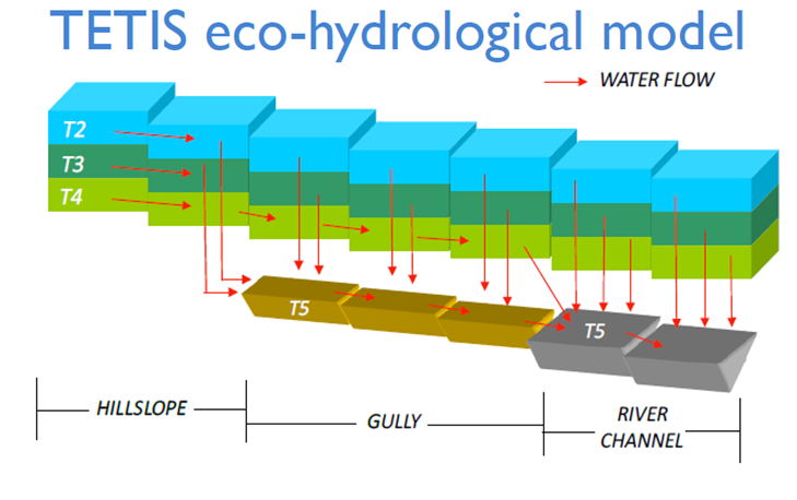

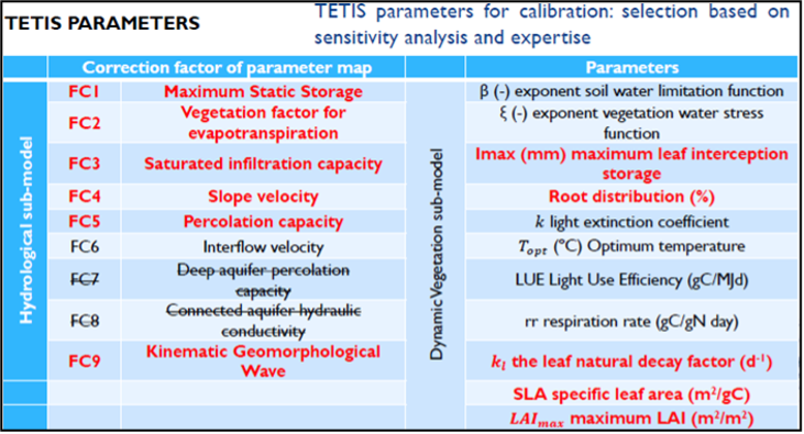
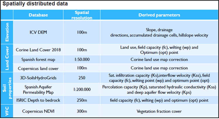
Figure: TETIS model and parameters, as well as the spatially distributed data used to run the model.
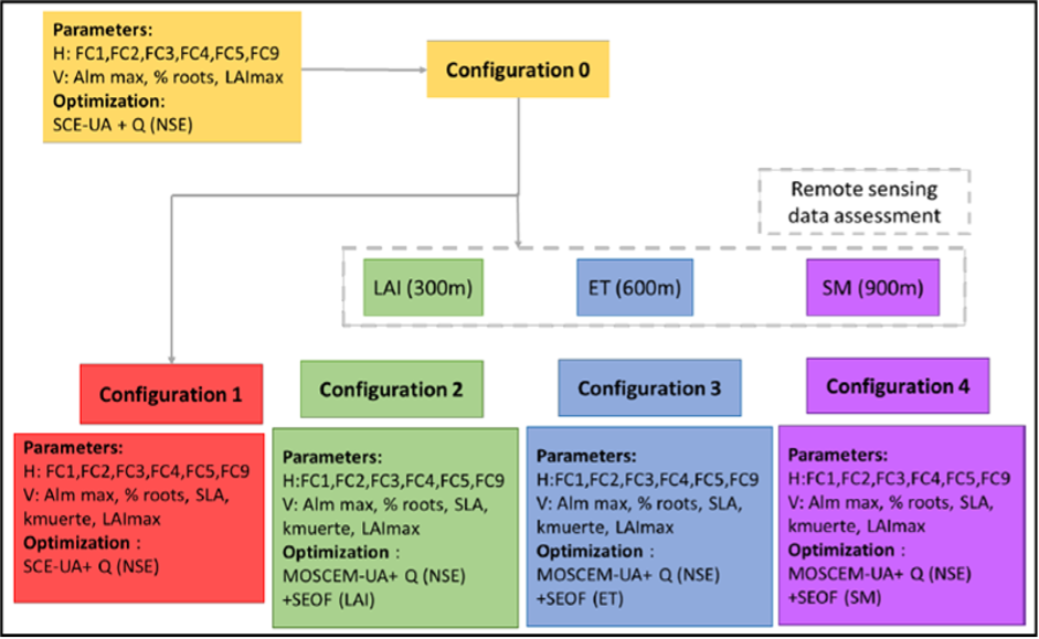
Figure: TETIS model calibration using remote sensing data

Cookies on utwente.nl

We use cookies and similar technologies and process your personal data (e.g., IP address) to personalise content and ads, to integrate media from third-party providers, or to analyse traffic. Data processing may also occur as a result of cookies being set. The data processing may take place with your consent. You have the right to withhold consent and to change or revoke your consent at a later time. For more information on the use of your data, please visit our privacy statement or cookie policy.