Lead: Giulia Vico (SLU)
Participate: Uni. Naples, Uni. Twente, UPV
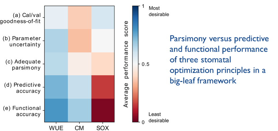
WP4 intercompares different models, soil and vegetation parametrizations and parameters. Analysis of water flow processes will be made, with the different models used in the different sites, e.g. in the soil-vegetation-atmosphere (SVA) system making use of the detailed field observations available in ARHO and integration of the data into a process-based ecohydrological model, considering also validation and output uncertainties. To facilitate the integration of models into the iAqueduct toolbox (Task 4.2), particular attention will be devoted to identify models that provide robust realistic results, while at the same time having low parameter requirements and easy transferability across sites. To this aim, a minimalist soil-vegetation-atmosphere model will be developed and its applicability across sites assessed, employing the data collated within this project.

Figure: WUE- Water use efficiency model; CM – Carbon Maximization; SOX – Stomatal Optimization based on xylem hydraulics (Bassiouni et al. 2021, New Phy.)

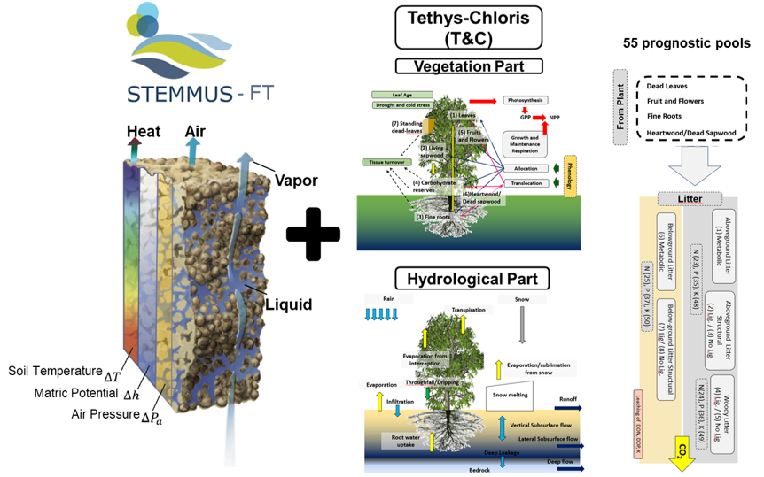
Figure: STEMMUS is coupled with T&C model for understanding the impact of detailed soil processes on ecosystem water, energy, and carbon fluxes (Yu et al. 2020, TC).

