Lead: Brigitta Szabó (CAR-HAS)
Participate: TAU, Uni. Naples, Uni. Twente
WP2 will retrieve soil hydraulic and thermal parameters (SHP/STP) from spectral signatures and knowledge of near-surface soil moisture dynamics. This WP will initially employ commonly used pedotransfer functions (PTFs) for regional applications and then locally calibrate them using readily measurable surface soil spectral features. The world Soil Spectral Library (SSL, Rossel et al. 2016, ERS), European Spectral Soil Library (LUCAS, Toth et al., 2013, EMA) and some local SSL (e.g. the GEO-CRADLE Mediterranean Balkan SSL) will be used to generate global to local spectral based models to assess soil properties. A harmonized protocol will be developed from the selected sites.
Task 2.1 Collection of field scale data
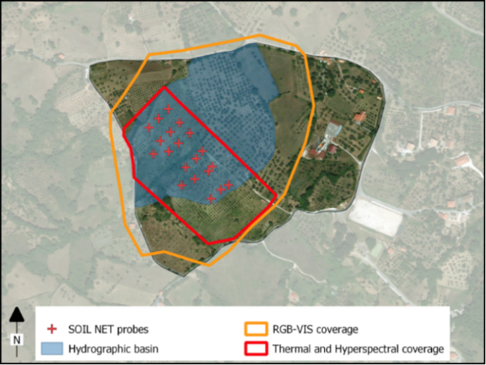
Figure: Map of the MFC2-Alento catchment. Red crosses indicate the locations of SoilNet sensors installed at soil depths of 15 cm and 30 cm. The positions of the SoilNet sensors correspond to soil sampling locations. The RGB-VIS coverage area is 18 ha, and the thermal and hyperspectral coverage area is 7.5 ha.
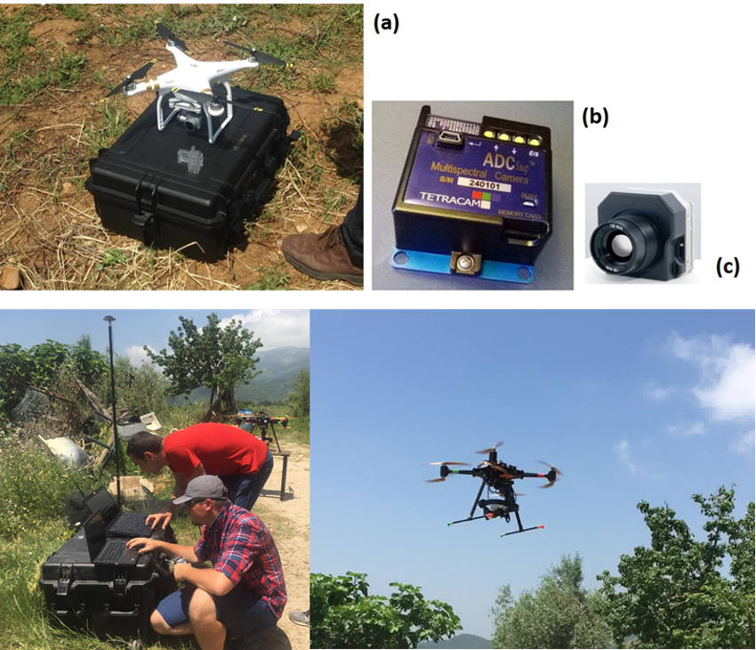
Upper figure: Overview of equipment for UAS flights including DJI Phantom 3 Pro (a) and payload: Tetracam ADC Snap camera (b) and FIR Tau2 camera (c).
Bottom Figure: Hyperspectral data collection with Cubert UHD-185 hyperspectral camera on UAS platform
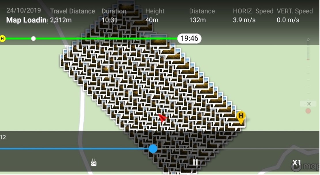
Figure: The impression of the number of UAS photos taken during a flight.
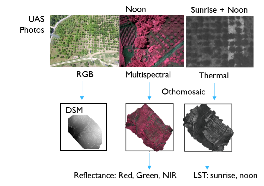
Figure: Different land surface features are retrieved from different UAS imageries
Task 2.2 Soil spectroscopy and hyperspectral remote sensing
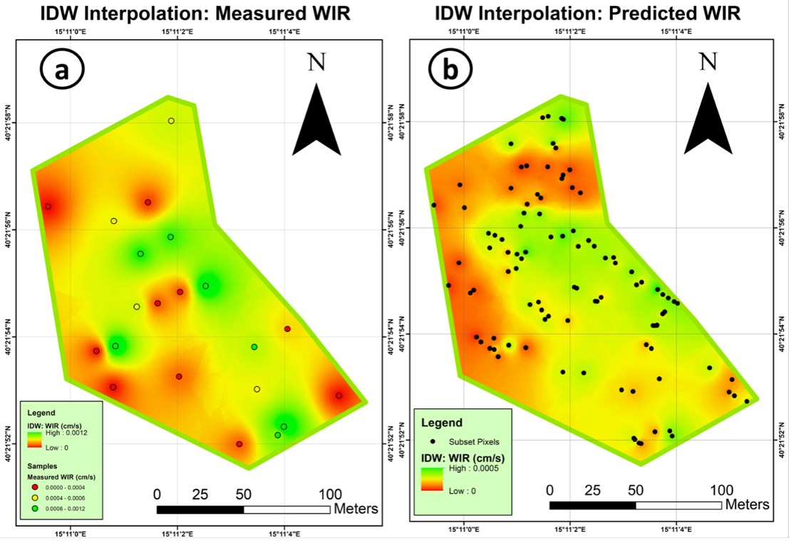
Figure: IDW interpolations of the measured against the predicted WIR (water infiltration rate) (based on Cubert UHD-185 hyperspectral Imageries) in the study site of Alento.
Task 2.3 Basic pedotransfer functions
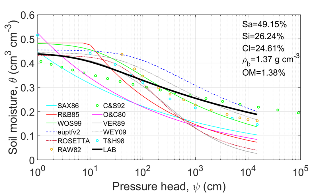
Figure: Comparison between observed and predicted soil WRF for sample#5 (texture classes, soil bulk density, and organic matter content are reported on the plot). WRF data pairs are built by obtaining soil water content values at 30 prescribed pressure head values (in most PTFs).
Task 2.4 Advanced pedotransfer functions
Hyperspectral data will be used to derive spectrotrasfer functions (STF) and spectral pedotransfer functions (SPTFs) using soil and environmental data as well. Such function will be used for the description and mapping of topsoil hydraulic properties with high level of details. Further to the site specific STFs the relationship between SSLs and hydraulic properties will be analysed on European datasets (LUCAS, EU-HYDI). Hyper- and multi-spectral sensors on ground and UAS will be employed for in-situ prediction of soil organic carbon (SOC), soil sealing and soil particle size distribution by vis–NIR spectroscopy. Soil hydraulic properties will be mapped for the study sites with SPTFs, STFs based on the available data, similarly to Task 2.3. Validation will be performed using measured values obtained in Task 2.1. Such task will support the downscaling procedures described in WP1 - Task 1.1.

