Lead: Salvatore Manfreda (Uni. Naples)
Participate: Uni. Twente, UPV, Uni. Basilicata
This WP will focus on the monitoring and downscaling of soil moisture data based on remotely sensed data. It is divided into two main trajectories: one aimed at the spatial description of soil moisture and the second focusing on the prediction of soil moisture in the root-zone. The WP will be developed in close connection with the activities of WP2.
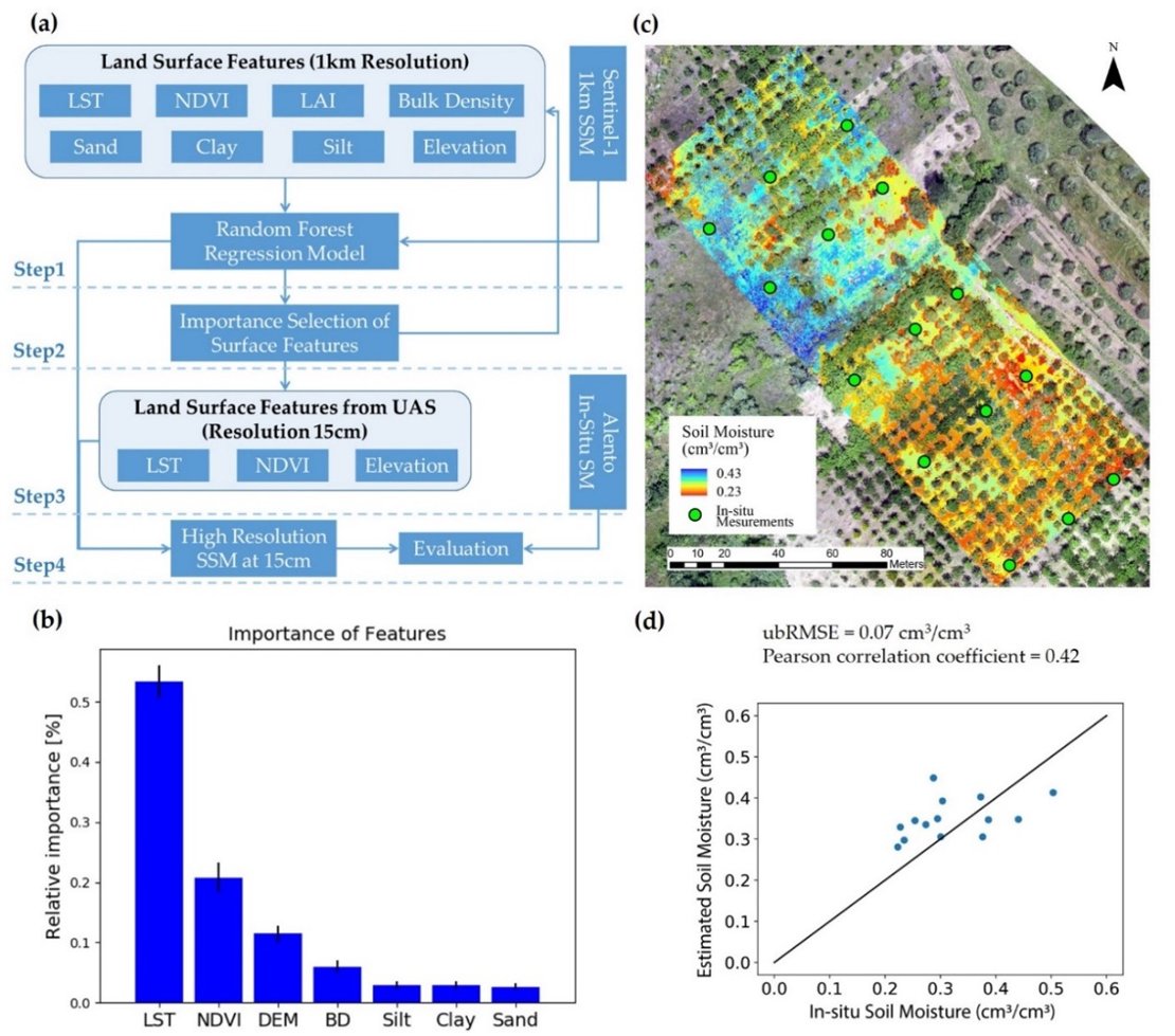
Task 1.1 Spatial downscaling procedures and data products

(a) Soil moisture downscaling workflow based on random forest regression (RF); (b) The importance of land surface features for the RF model; (c) RF-based downscaling of Sentinel-1 soil moisture products at 1km to 15cm, taking land surface features derived from UAS as predictors over the MFC2-Alento catchment. The UAS thermal image taken at sunrise 05:13 14 June 2019 was used to derive LST, the multispectral image taken 15:42, 13 June 2019 was used to derive NDVI; (d) the comparison of the downscaled soil moisture with in situ measurements. (see Publication 1)
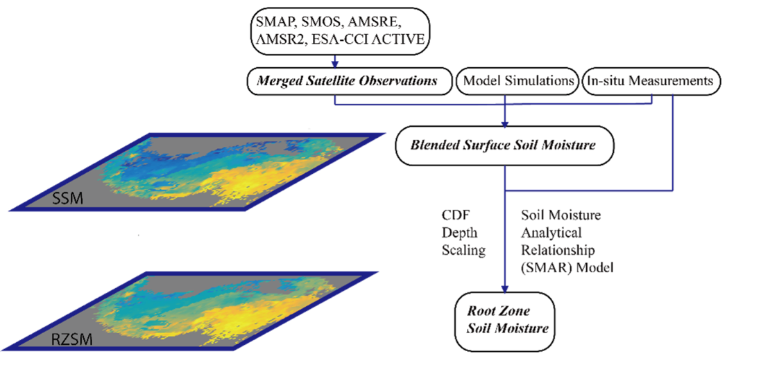
Task 1.2 Derive profile soil water content from surface soil moisture information

The example workflow for deriving root zone soil moisture (RZSM) from surface soil moisture (SSM), which results in ~10-year consistent surface and root zone soil moisture over Tibetan Plateau (see publication 2).

