Fiumarella of Corleto belongs to the Basilicata region that is characterized by a significant diversity in terms of climatic conditions. For instance, the mean annual rainfall ranges between 400 and 2000mm. Such variability reflects the regional hydrological patterns with areas affected by droughts and others that experience several floods and landslides. In this context, the study of river basin hydrology becomes critical from several points of view. The Fiumarella of Corleto is located in the water-rich part of the region that is crucial for the water supply of the region but also for the water supply of the Puglia region, which strongly relies on external resources for their agricultural and economical activities.
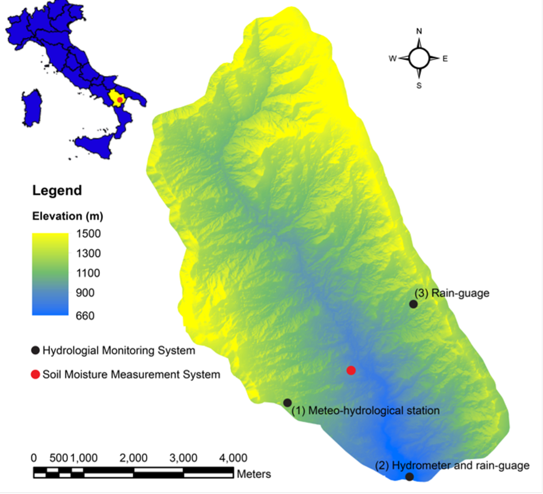
The experimental basin “Fiumarella of Corleto”, located in Basilicata region (southern Italy), is a tributary of the Sauro river (Agri basin) and has an area of 32.5 km2. It is situated in a sub-humid climatic zone with a mean annual rainfall of approximately 720 mm and characterized by hot-humid summers and chilly to mild winters. The interest towards this basin is due to its peculiarities. In fact, the two slopes of the catchment have different land uses: The slope on the left is covered mostly by forests, the slope on the right is covered by agricultural land. In order to characterize with a high level of details the morphology of the two slopes, a DSM of the basin at high-resolution (1 × 1 m) was derived with a LiDAR.