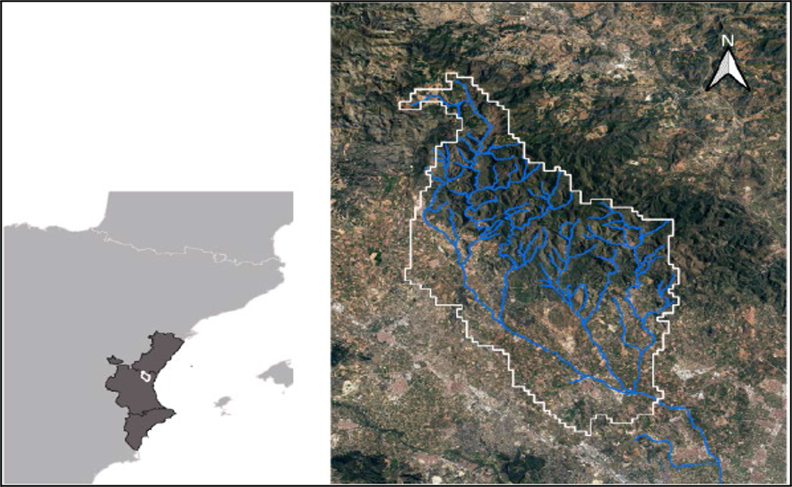
Barranco del Carraixet (or Carraixet Creek) is located in the east coast of Spain, has a catchment area of 314 km2, draining directly to the Mediterranean Sea, with a natural park in the upper part of the basin and with anthropogenic pressures in the middle and low basin. The human effect is quite important in this study site: The lowlands are characterized by alternation of the urban and industrial zones and agricultural fields, while the upper part is frequently affected by wildfires and it is a highly frequented leisure zone, subject to multiple pressures (hunters, several outdoor sports, owners, etc.). The climate is semiarid Mediterranean, with a mean annual precipitation of around 400 mm highly variable and potential evapotranspiration of 1100 mm. The hydrology is characterized by low or absent base flow, typical of Mediterranean ephemeral streams. Urban and irrigation water demands are supplied by the aquifer, mainly recharged by the upper catchment. The actual trend of the catchment is towards forest expansion in abandoned lands of the upper part and urbanization in the lower part. The main concern in Carraixet Creek is to improve forest management in order to increase aquifer recharge, increase the forest health, and to better control soil erosion. For this project, we will consider the upper and medium parts of the catchment, with an area of 250 km2. Within this area, there is one experimental watershed of 1 km2 (with 3 meteorological stations, 1 cosmic ray, and 1 flowgauge) and 1 experimental forest plot heavily sensorized. At the catchment scale and operated by the Jucar Basin Water Authority, there is one additional flowgauge station and several raingauges and piezometric observations.