Region: India
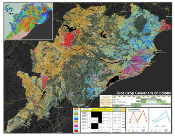
Description: This project was a part of the “Enabling Crop Analytics at Scale” program, supported by the Bill and Melinda Gates Foundation and managed by Tetra Tech’s AGDATA Acceleration Facility. In this collaborative project, IFPRI, in partnership with aWhere, ITC, and ICRISAT, addressed two interlinked bottlenecks in the collection of ground-truth data for crop analytics: 1) ineffective sampling strategy at the landscape scale, and 2) inefficient yield measurement at the field level. The project used terrestrial remote sensing and 3D imaging technologies at strategically chosen locations in Odisha, India, to improve both crop yield measurement accuracy and its representativeness for the surrounding landscape. Tthe project team developed a new, scalable crop yield measurement approach based on Dynamic Area Sampling Frames (DASF) and 3D imaging technology using the Terrestrial Laser Scanning (TLS) and the Structure from Motion (SfM) approaches.
Partners: IFPRI, ITC, ICRISAT, AWhere
Sponsor: Bill and Melinda Gates Foundation
Contacts: Andy Nelson, Kees de Bie