The Natural Resources Department is committed to finding sustainable solutions for the management and protection of our planet's natural resources. Our researchers work on many projects around the globe, making a meaningful impact on all kinds of communities and ecosystems.
Our department's international reach allows us to collaborate with a diverse group of partners, including governmental organizations, universities, NGOs, and local communities. Together, we strive to create a positive change for the environment.
For any project inquiries please contact NRS Project Officer Lisette Meulman.
Browse our project portfolio:
- ProjectsYear of startContinentTopics

Biodiversity Precursors – EO4Diversity
EO4DIVERSITY addresses important biodiversity science gaps, including forecasting ecological degradation in order to define effective actions to reduce terrestrial biodiversity loss.
BIOSPACE
The aim of the BIOSPACE project is to monitor biodiversity by upscaling field observations and genomic (eDNA) information using next generation satellite remote sensing
COMBINED Climate-Nature Interactions
How do changes in biodiversity and climate affect each other in Dutch landscapes? That question is at the heart of the COMBINED project.
Consultancy on food networks
The objective of this collaboration agreement is to generate a detailed map of Rwanda’s transport network, updating current analytics developed, to support DI. Specifically, the collaboration will seek to explore the potential for integrating commodity flow and seasonality information into the model, for a more detailed understanding of Rwandan food environments.
Crop Production Analytics using Dynamic Area Sampling Frames and Smartphone 3D Imaging (Partners)
The project used terrestrial remote sensing and 3D imaging technologies at strategically chosen locations in Odisha, India, to improve both crop yield measurement accuracy and its representativeness for the surrounding landscape.
e-shape, EuroGEO Showcases, Applications Powered by Europe
The project aims to improve user uptake of Earth Observation data. It will develop operational EO services and demonstrate the benefits of the EO pilots at national and international scale, across vertical markets (private and public), and amongst key user communities.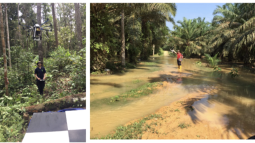
Ecological and Socioeconomic Functions of Tropical Lowland Rainforest Transformation Systems (Partners)
Due to population growth and the increased demand for palm oil from the industry, many farmers have decided to cultivate oil palm on their terrains and many large-scale oil palm plantations have been established. However, transforming forests or diverse agroforest landscapes into these monoculture plantations may have dramatic consequences for the environment. EFForTS aims to gain in-depth knowledge about the working of forests and different forms of oil palm cultivation, and how to maintain or restore ecosystem functions on these plantations.
EO-based drought model for African pastoral areas
An Innovative EO Based drought model for African pastoral areas to improve sovereign disaster risk management under African risk capacity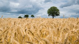
EO4CerealStress
EO4Cerealstress will evaluate the synergistic use of multi-source Earth Observation data, particularly hyperspectral data, in-situ crop physiological parameters, soil, climate, and other ancillary data- taking advantage of their complementarity - to understand the effects of multiple stressors and their cumulative effects on crops. New and planned European satellite missions are providing data at high spatial, spectral and temporal resolutions, which offer the opportunity not only to understand and monitor the impacts of single crop stressors but also multiple crop stressors. The project aims to develop products that can be used to monitor these stressors and provide a scientific roadmap for the future development of EO products and techniques for monitoring multiple crop stressors.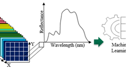
EO4Nutri
EO4Nutri brings together the capabilities of various Earth Observation (EO) data and analytical techniques to estimate and predict the field-level nutrient content of soil, canopy, and yield for important global staples.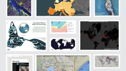
Erasmus Mundus Joint Degree Programme - GEM
GEM is a two-year MSc in Geo-information Science and Earth Observation for Environmental Modelling and Management. The aim of the GEM programme is to deliver top-class graduates from the EU and around the world, with the skills and networks to better manage socio-ecological systems for sustainable and equitable growth. It is a prestigious programme that offers around 15 Erasmus Mundus Scholarships per intake
ESA EO Africa
The objective of this initiative is to build an African-European R&D partnership to facilitate the sustainable adoption of Earth Observation and related space technology in Africa. The initiative will be driven by African research challenges and user needs, and will follow a long-term vision (>10 years) for the emergent digital era in Africa as outlined in the “Agenda 2063 – The Africa we want” of the African Union Commission (AUC).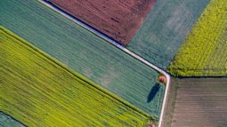
ESA LUISA - Land Use Intensitys potential, vulnerability and resilience for Sustainable agriculture in Africa
The primary objective of LUISA is to develop and implement new methods, effectively linking and integrating modelling, satellite EO products (Sentinels, Explorers, Meteo missions, ESA-CCI) and dataset with in-situ, stakeholder-generated, social-economic data to advance the estimation of continental Africa potential, vulnerability and resilience for a sustainable agriculture.
FAO Rice Field Boundaries
The project aims at developing a spatially explicit agricultural database in support of agricultural planning. The considered study areas are in Cambodia and Viet Nam, where rice paddy occupy a substantial portion of the agricultural area.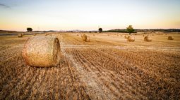
FAO State of Food and Agriculture (1 & 2)
The State of Food and Agriculture 2020 presents estimates on the pervasiveness of water scarcity in irrigated agriculture and of water shortages in rainfed agriculture, as well as on the number of people affected.
FoodGravity
This project aims to power a classic geography model Gravity with artificial intelligence, to model the food movements between places.
Global Accessibility Map
Access to the resources, services and opportunities that are concentrated in cities is an important and frequently used indicator for rural development, agricultural productivity, access to markets for both food consumers and food producers and trade. Inequalities in access can lead to greater social and economic divides. Poorly planned expansions of transport networks can also degrade the natural environment, leading to deforestation and the over exploitation of easily accessed natural resources. On the other hand, well planned improvements in access can lead to better outcomes in rural health, wealth and economic livelihoods whilst limiting environmental impacts. To map the degree of access to resources and inequalities in access, ITC along with Oxford University and the Joint Research Centre of the European Commission built on previous work by Andy Nelson to develop a dataset on global travel times to the nearest city of 50,000 or more people and demonstrated negative relationships between rural wellbeing and travel time to these cities.
HE - OBSERVATION OF ECOSYSTEM CHANGES FOR ACTION (OBSGESSION)
The objective of OBSGESSION is to predict and monitor biodiversity and its direct and indirect drivers in terrestrial and freshwater ecosystems through Earth Observation (EO) imagery, innovative in-situ (including citizen science) data, and products, together with next-generation ecological models.
HyNUTRI
HyNutri used Sentinel-2 multispectral broadband and new generation PRISMA hyperspectral narrowband data to predict the field-level nutritional composition of important staple grains.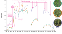
HyRelief
HyRelief enhances the thermal instrument on board the International Space Agency (ECOSTRESS) drought monitoring products with a new generation of hyperspectral satellites (ENMAP+PRISMA).
Ingenuity EO4All
EO4All is working group founded by EO women scientists at ITC. The working group aims are to enhance ITC's visibility in the EO community and policy fields, advance EO science, promote gender equity (inclusion) and diversity, support student intakes and project acquisitions led by women from new partnerships and target groups.
KNAW Pilot Fund Science Communication
Science communication is a crucial tool for achieving positive societal impact. How can science communication become an integral part of our tasks as academic? How can Early Career Researchers learn how to do science communication in a meaningful way? How can we measure the impact of our science communication? The aim of the Gewaardeerd! (Rewarded!) project was to stimulate experienced science communicators, facilitate new initiatives, and gather insights for a national guidelines in effective science communication. Wieteke Willemen, together with ITC colleagues Arjan Dijkstra and Frank van Ruitenbeek teamed up to give science communication for global sustainability issues a boost.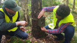
Monitoring Wild Boar
Wild boar population is reported to increase in the province of Overijssel. As they are often involved in road accidents and cause damage to crops, their presence needs to be monitored. Furthermore, wild boars are the vectors of African swine fever, a devastating infectious disease of pigs. Wild boar movement from neighbouring countries (e.g. Germany) poses a high heath and economic risk for pig farms. However, population estimation and monitoring is not straightforward as wild boars are cryptic, nocturnal species. The province of Overijssel (Fauna Policy Implementation office) requested the UT to provide advisory on a protocol for the estimation of the population of wild boars.OBSGESSION
To advance the understanding of direct and indirect drivers of biodiversity change through cutting-edge data integration and modeling, addressing science-policy gaps, supporting conservation planning, and sharing knowledge with international and EU stakeholders in ecosystem and biodiversity management.
OKP TMT Vietnam
Capacity building on sustainable shrimp farming and mangrove restoration for climate resilient rural development in the coastal areas of the Mekong Delta, Vietnam
People-ECCO
The two overarching goals of the PEOPLE-ECCO project are to (i) engage CSOs/NGOs active in ecosystems conservation by involving them in the co-design of Earth Observation-supported methodologies applicable in their operational practices and though EO capacity building activities, and (ii) develop, test, demonstrate and validate EO-integrated methods, based on the identified user requirements and co-design.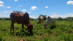
RANGE
RANGE aims to strengthen the resilience of communities in Arid and Semi-Arid Lands (ASAL) in the Isiolo, Marsabit and Samburu counties hrough multiple interventions and capacity-building activities.
Senior Expert at Livestock Agri-Food Systems
Livestock productivity is critical for pastoralists in semi-arid Africa, who largely depend on milk and meat production for their livelihoods. Climate variability strongly influences this productivity; for example, African rangelands face frequent droughts that can lead to livestock loss through reduced availability of forage and water. At the same time, livestock affects climate through the emission of greenhouse gases, although large uncertainties exist in emission estimates over rangelands. Satellite remote sensing can help to reduce some of those uncertainties, and provide important information on rangeland conditions and management. This can help to design, promote, and monitor resilient livestock production systems. As part of the NL-CGIAR partnership, this Senior Expert assignment contributed to ILRI’s agenda on sustainable livestock production systems and drought risk management by exploring options for improved rangeland monitoring using earth observation satellites.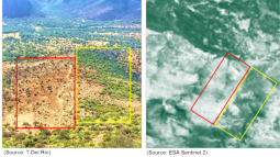
Space4Restoration
Space4Restoration aims to design, test and finetune a scalable online remote sensing-based method to monitor and evaluate restoration actions across biomes. In this project we build on the work pioneered by ITC and in very close collaboration with organisations working on international restoration standards, and practitioners for test sites and user perspectives.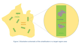
Statistics from Space, Next Generation Agricultural Production Information for Enhanced Monitoring of Food Security in Mozambique (Partners)
The project will produce and disseminate accurate agricultural production statistics data based on Earth observation data, digital field data collection and spatial analytics and modelling. The aim is to generate production information in a sufficiently timely manner that all market participants can use the information for decision-making.
The resilience of domestic transport networks in the context of food security – a multi-country analysis
The flow of food from producer to consumer is vulnerable to shocks at many stages of its journey, but the resilience of this flow to shocks has rarely been studied, especially in comparison to the number of studies that have looked at production shocks. This project contributes to 2021 edition of the FAO flagship publication The State of Food and Agriculture (SOFA), on building resilient food systems for food security and nutrition. It developed and demonstrated a spatial workflow and resilience metrics to analyse transport network structure in the context of national food transport network resilience.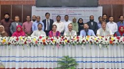
TMT+ Bangladesh
This training project took part partially online, and physically in the Netherlands and Bangladesh. It aimed at building the capacity of BARI and BARC scientists in analyzing agro-geospatial big data in key research domains including crop mapping and yield prediction. Developed with BARI and BARC (Bangladesh Agricultural Research Institute and Council).
Towards a green and more liveable Paramaribo
What are the advantages of urban green spaces the tropics where vegetation and lifestyle are clearly different? And how can information and understanding help to motivate people to promote and protect greenery in the city? Tropenbos Suriname and the University of Twente have been working together since 2018 in a twinning context; we learn from each other. In Paramaribo, the capital of tropical Suriname, we aim better understand this role through remote sensing, spatial modelling and we are testing the use of small weather sensors to measure the cooling effect of vegetation by developing three consecutive projects (UTSN, NWA Klein and UT Geo-CS Hub). Beside this, we developed free teaching materials, are freely sharing all our data for use by others, and are organizing activities for residents.
VU-UT collaboration - PlasticFree
The PlasticFree project integrates behavioural and spatial science to address plastic usage in grocery shopping behaviours.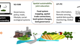
VU-UT Collaboration - Spatial sustainability joint education
As part of the strategic collaboration ambitions between the Vrije Universiteit (VU) Amsterdam and the UT this project explored the options for joint education on the topic of spatial sustainability.

