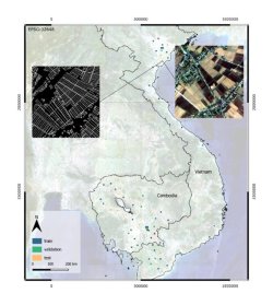
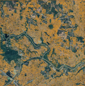
Description: The project aims to develop a spatially explicit agricultural database in support of agricultural planning. The considered study areas are in Cambodia and Viet Nam, where rice paddy occupy a substantial portion of the agricultural area. The obtained geospatial database of rice farms will be used to increase the availability and quality of farmland information to: (i) support the definition of effective schemes of farming incentives, (ii) support the formulation of smart agriculture/microfinance programs, and (iii) improve reporting on Sustainable Development Goal (SDG) 2.4.1 for sustainable agriculture. The project is supported by the Ministry of Agriculture, Forestry and Fisheries (MAFF) of Japan and implemented by the Statistics Division of the Food and Agriculture Organization (FAO) of the United Nations.
Partners: NRS-ITC
Sponsor: FAO
Contacts:


