El Bruc
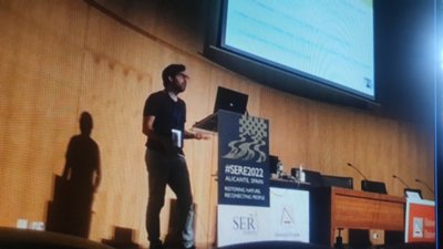
Bernat walked the stairs to reach the stage, upon the large auditorium of the University of Alicante (Spain). Under the lights, with his presentation set up, he showed the attendees of the SERE2022 (Society for Ecological Restoration Europe) the focus of his work during the last 4 years of his life. It all starts with a picture of a forest.
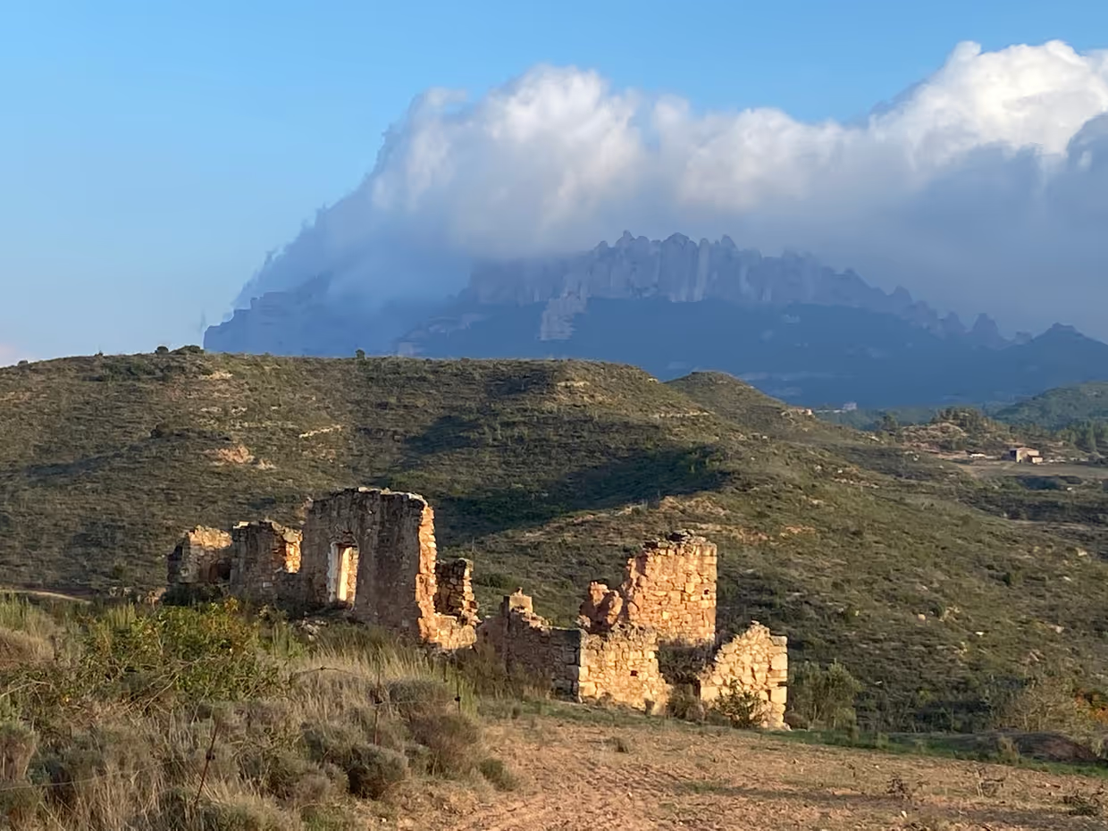
El Bruc is the name of a locality situated at the foot of the Montserrat mountain, in the province of Barcelona, Spain. Its woods represent a legacy of legends and history that start in the pre-historic ages, pass through the Spanish Independence wars against Napoleon and last until modern times. However, the magical forests of El Bruc are experiencing a series of dark episodes, since being a victim of a forest fire in 1986.
The area has been part of different European Commission’s Life 2020 funding programs. In 2014, it was included in a program called “Life Montserrat”. Its main objectives were the prevention of wildfires, the conservation of biodiversity and the creation of a mosaic. Unfortunately, another fire destroyed the area in 2015. A new restoration project lead by CREAF, “The Green Link”, was developed, whose goal was to restore desertified areas with an innovative tree growing method – the Dutch company Land Life “Cocoon”.
a new methodology
Not too far from this land, Bernat Dorado was finishing his MSc remote program (iGEON) in GIS, Remote Sensing and Natural Resource Management (ITC Faculty), and was about to find his perfect Thesis topic. Bernat had for certain that he was going to study the El Bruc area, as he wanted to physically “step on the ground” he was going to investigate. Now, with his feet on the stage and the project behind his back, he explains to us how he reached the perfect topic; “My idea, in the beginning, was a bit different; I planned to assess the restoration intervention by quantifying ecosystem services related to erosion and its temporal progress (before fire - post fire - after restoration) but the field data needed for that was not available” he confesses. “Then I came up with the idea; how can you assess post-fire restoration interventions? No one knows if an area is going to burn therefore there’s usually no recorded field data before the event. Let’s develop a cost-effective methodology that doesn’t require it, fed by remote sensing data only”.
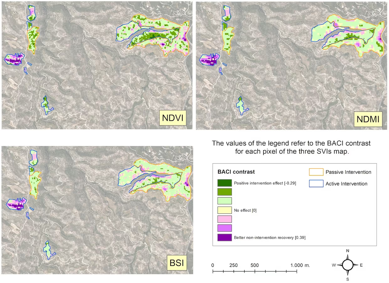
This insight led him to conduct a study that observes three main biophysical variables through spectral indices: the vegetative cover, the moisture and the bare soil. He aimed to develop a methodology to monitor with open tools while using several indicators each of them showing different attributes. This approach showed that the use of one sole variable could lead to an incomplete conclusion about the performance of the intervention, along with other findings: he proved that the orientation of the terrain affects the restoration and that different types of restoration deliver different results based on the biophysical variable that you observe.
“Another interesting finding” points out Bernat to the screen on his back “We could also observe that restoration effects were minor in areas that better self-recovered after the fire than in those in which no natural revegetation took place before the intervention begun”. This serves to reach one conclusion: it is very important to adjust intervention strategies based on the state of the area and its topographical attributes.
a look into the future
With large-scale restoration projects as a keystone of the European Union activities to address climate change and biodiversity loss, the relevance of this study increments every day as affordable ways to monitor intervention efforts will be needed. The new restoration projects must be aligned with the future and with climate change perspectives, and this has to be communicated. “It is very important to connect with society to explain why we are restoring in a certain way, and why some areas are not going to look the same as before a fire. We have to engage responsibly with complex ecosystems and changing climatic conditions in order to create sustainable, supportive, and productive relationships between the built environment and nature. Restoration will be a crucial activity on the planet during the next 30 years” explains Bernat.
The presentation and the SERE2022 conference ended with an applause, but there is still a lot more to do for Bernat Dorado. Working at the interface of academia, policy and practice is the goal in his mind, as he described in his Professional Outlook interview. You can read his MSc Thesis here.
More information about CREAF
The CREAF (Ecological and Forestry Application Research Center), based in the Autonomous University of Barcelona, is a public research center that focuses in restoration to address climate change and biodiversity loss.