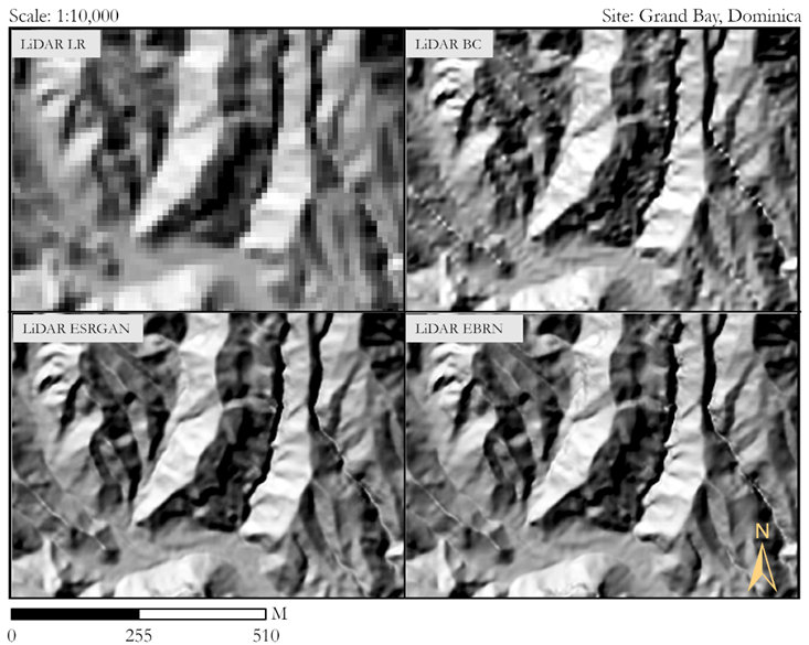
Figure 1. Resolution improvement in DEM data using ESRGAN and EBRN super-resolution models
The losses due to natural hazards are very high and show an increasing trend due to climate change, human and economic growth, and unplanned development. The risk due to those hazards can be reduced using multi-hazard risk assessment using hazard, the element at risk and vulnerability data. However, due to the lack of good quality and high-resolution data in developing nations, modelling hazards at the infrastructure level is difficult.
To solve that, our research aimed to increase the applicability of physically-based models in data-poor regions by improving the spatial resolution of globally available datasets by using deep learning-based Super Resolution. We used the high-resolution digital elevation models from Austria to train the Super Resolution models on the Geospatial Computing Platform of ITC. Then we used the trained model in the data-poor region with the global dataset to increase spatial resolution. Those super-sampled data were then further used in physically-based modelling of multi-hazard scenarios, including flooding, debris flow, and landslides. Figure 1 (above) shows an example result of the study with increased spatial resolution using super-resolution models (ESRGAN and EBRN) compared to existing methods. Figure 2 (below) represents the improved physically-based modelling accuracy using super-resolution data in down-sampled LiDAR DEM and global SRTM DEM.
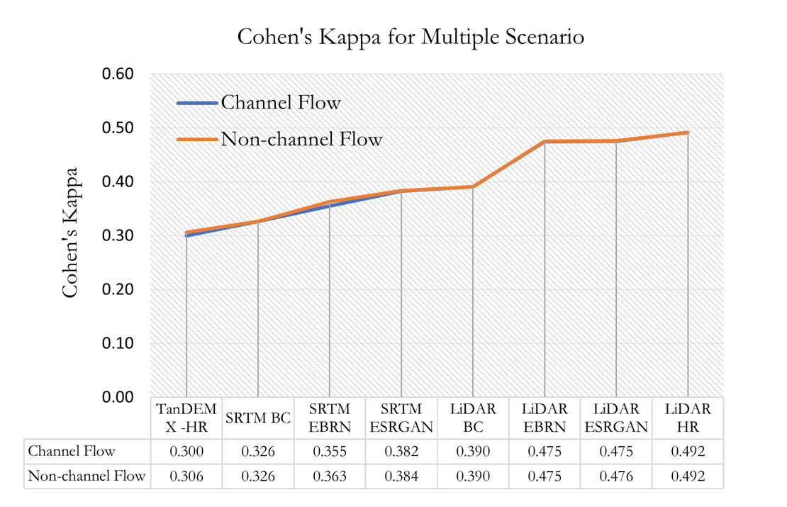 Figure 2. Improvement of Physically Based Modelling Results using data from Super Resolution
The Geospatial Computing Platform was an excellent platform for such type of work due to it’s ready to use system configuration and excellent user support. There were no technical issues while using the platform for this research and it helped to reduce cumbersome time required for configuration of libraries and system components. The performance of the platform was also sufficient.
For more information, you can read Dahal, Ashok (2021) Super resolution aided multi-hazard modelling: Is it possible? or watch me explaining the study (video).