Urbanization is happening at a rapid space as more people choosing to live in cities for better opportunities. Mapping and measurement key attributes of temporal urban expansion and evaluating the quality of urban expansion based on mapping physical layouts of urban areas gives insights about orderly (productive, inclusive and sustainable) or disorderly (non-productive, non-inclusive and non-sustainable) city expansion. Main objective of this study is to create citywide maps and spatial data based on physical characteristics of urban fabric (block layouts and roads) which can be translated using geospatial analytics to understand the quality of urban expansion.
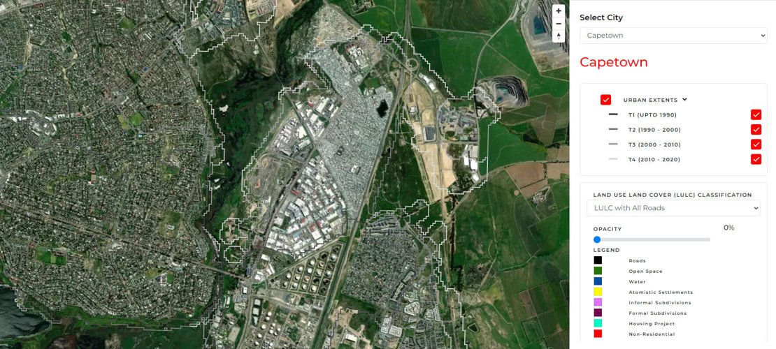
Figure 1. Subset of urban layouts of Capetown city is visible in the above image. Temporal urban extents overlaid to understand how urban layouts developed over time.
Based on physical characteristics of urban fabric (irregular layouts, conformity to land subdivision and level of regularity) different land use categories (atomistic settlements, informal land subdivisions, formal land subdivisions) defined. Land use label data generated using high-resolution satellite imageries available in JOSM platform. Deep learning Convolutional Neural Network (CNN) model built using ResNet-50 architecture and implemented in CRIB's Geospatial Computing Platform (GCP) to generate the final results.
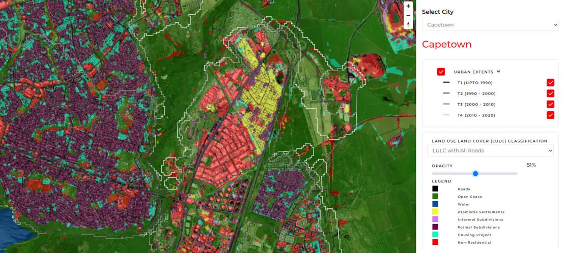
Figure 2. Above image shows land use classes predicted in the subset of Capetwon city based on deep learning built model.
In this project major challenge was to process large volume of satellite data and create efficient machine learning workflow for the computation. GCP supported handling large volume of data and its GPU based computation capability provided the edge in developing an efficient workflow. The platform comes with already installed machine learning Python packages (Tensorflow, keras etc) along with all geospatial packages and associated dependencies, so we don’t have to worry about package installation hassles and its helps to focus more on to building the efficient machine learning workflows.
For more information:
C-40 Cities Land Use Land Cover Classificationhttps://www.mapdatalab.com/c40city/
Atlas of Urban Expansion
http://atlasofurbanexpansion.org/