Land Surface Temperature (LST) is significant for climatological and environmental studies. LST products acquired from satellites, however, suffer from the tradeoff between spatial and temporal resolution. Spatial downscaling has emerged as a well explored field aiming to overcome limitations arising from this tradeoff. Previous research on regression based LST downscaling models focused on utilising predictors derived from optical imagery for constructing such spatial downscaling models. Weather-dependent nature of optical imagery data, however, can influence downscaling models and render them ineffective during bad weather conditions like high cloud cover.
To cope with this issue, in our research, we involved predictors derived from the weather-independent Sentinel-1 Synthetic Aperture Radar (SAR) imagery to downscale MODIS LST products. To achieve this we utilised traditional machine learning algorithms such as Random Forest and also proposed novel downscaling architecture based on Convolutional Neural Networks.
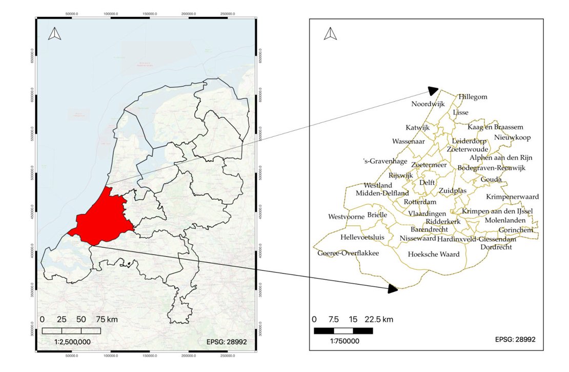
Figure 1. Map showing the study area: Zuid-Holland province (left) and various municipalities in Zuid-Holland province (right)
Upon conducting a comparative analysis between the outcomes derived from optical predictors and those obtained from radar predictors, it was noted that radar-based downscaling models exhibited suboptimal performance. This diminished efficacy can be attributed to the more complex nature of radar imagery. Nonetheless, despite a marginal loss in accuracy, the employment of radar predictors enabled the downscaling models to operate independently of weather conditions. This revelation underscores the imperative for further investigation in this domain, especially through the application of more sophisticated and deep neural network architectures, incorporating comprehensive radar datasets (for e.g., incorporating phase information to model temporal variations in LST).
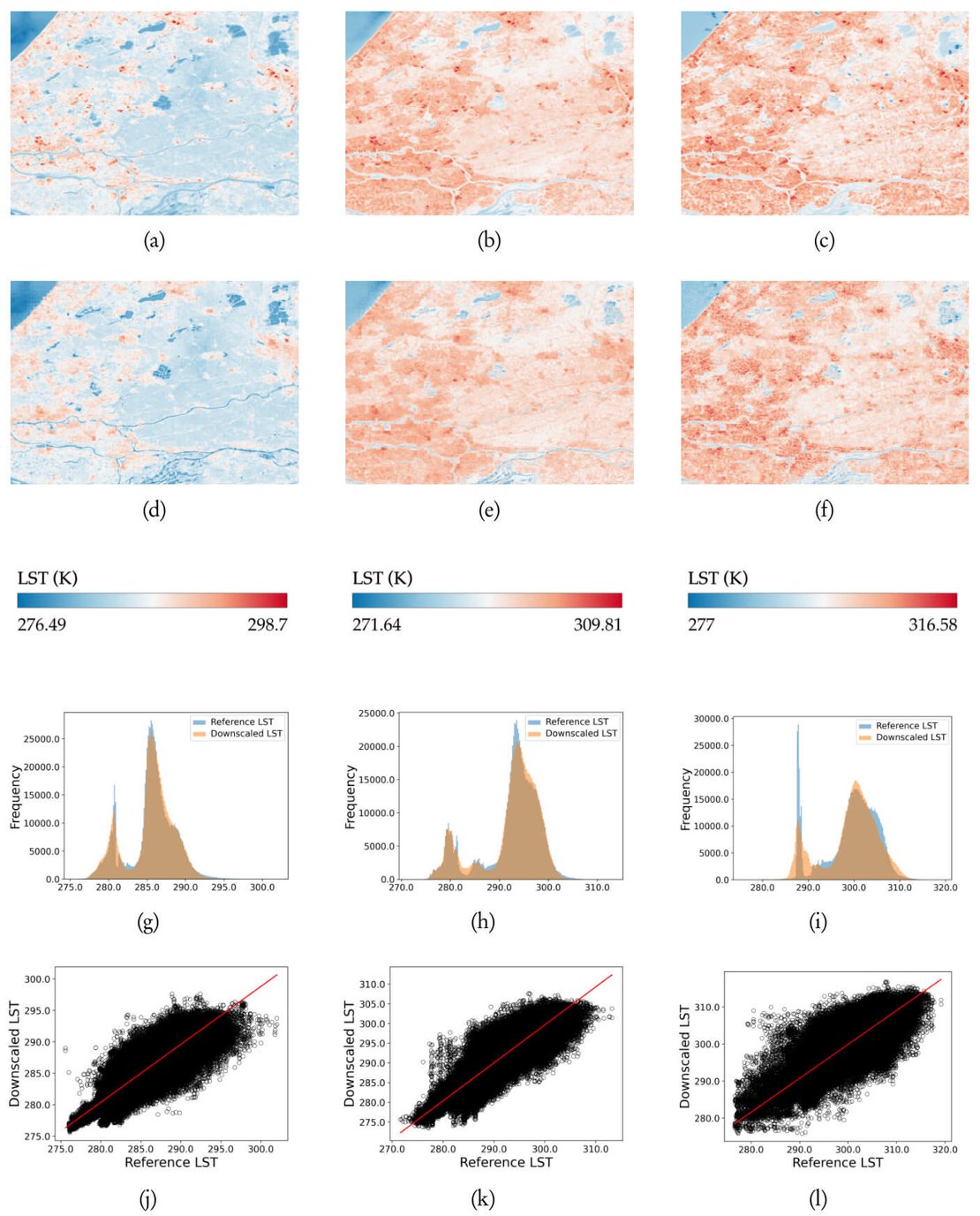 Figure 2. Results of the Case 3 radar-based RF downscaling experiment. Here, (a), (b), and (c) refer to validation Landsat-8 LST (100 m) acquired on 25/03/2020, 10/04/2020, and 28/05/2020, respectively. (d), (e), and (f) refer to the achieved downscaled LST images (100 m) for 25/03/2020, 10/04/2020, and 28/05/2020, respectively. (g), (h) and (i) refer to the histograms and (j), (k), and (l) refer to the scatterplots obtained on comparing downscaled LST images (100 m) to the Landsat-8 validation LST images (100 m)
Given the reliance of this research on machine learning, the necessity for GPUs for training was evident. We were privileged to utilise the Geospatial Computing Platform, which gave us access to ample computational resources for both training and evaluating our models. The presence of standard geospatial and satellite analysis modules, in addition to conventional machine learning frameworks on the computing platform, significantly reduced the time required for environment configuration, thereby allowing for an increased focus on actual experimental research.
My experience with using the platform was exceptionally positive. I am also immensely grateful to the Centre of Expertise in Big Geodata Science (CRIB) team for their quick support with several issues I encountered previously. For researchers working at the intersections of satellite big data, machine learning, and geospatial analysis, the Geospatial Computing Platform stands out as the ideal platform specifically tailored to meet their needs.
For more information:
Patel, Nishit (2023) Downscaling Land Surface Temperature using SAR images : A Machine Learning framework.