Urban change detection plays a critical role in many domains such as city planning, infrastructure development, risk assessment, and land-use planning. However, the accurate classification of different types of changes in a 3D urban environment remains a challenging task. Conventional methods, which typically involve transforming the data into a DSM or Voxels, often fall short in managing the complexity of point clouds. On the other hand, more complex deep learning models have shown promise but still face challenges in real-world applications. The Master's thesis aimed to address these challenges by implementing and evaluating three models: Random Forest, Fully Connected Neural Network, and Convolution Neural Network.
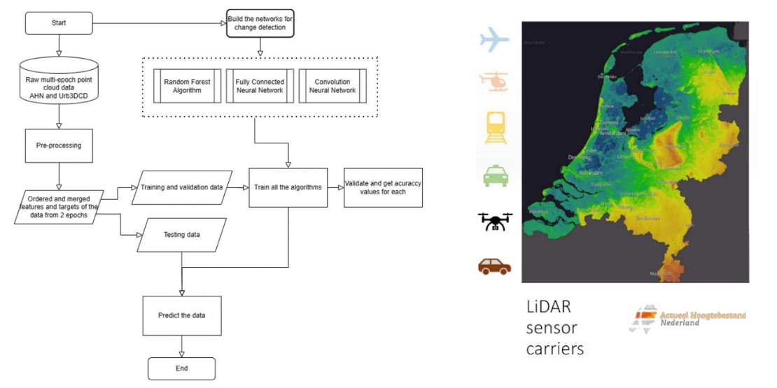
Figure 1. An overview of the methodology (left) and AHN acquisition methods (right)
The models are trained and validated on two distinct datasets, simulated Urb3DCD dataset and a real-world AHN dataset from the Netherlands, and are later assessed on their ability to accurately classify different types of changes. Findings reveal that while all models demonstrate strong performance, each has its strengths and weaknesses. The results obtained from the simulated dataset were outstanding. When applied to the AHN dataset, the performance is found to be highly sensitive to feature selection, the quality of training data, and how representative the data is. The direct comparison of classes between the simulated and real datasets indicates superior results from the simulated dataset, suggesting the need for better-quality training data for real-world applications.
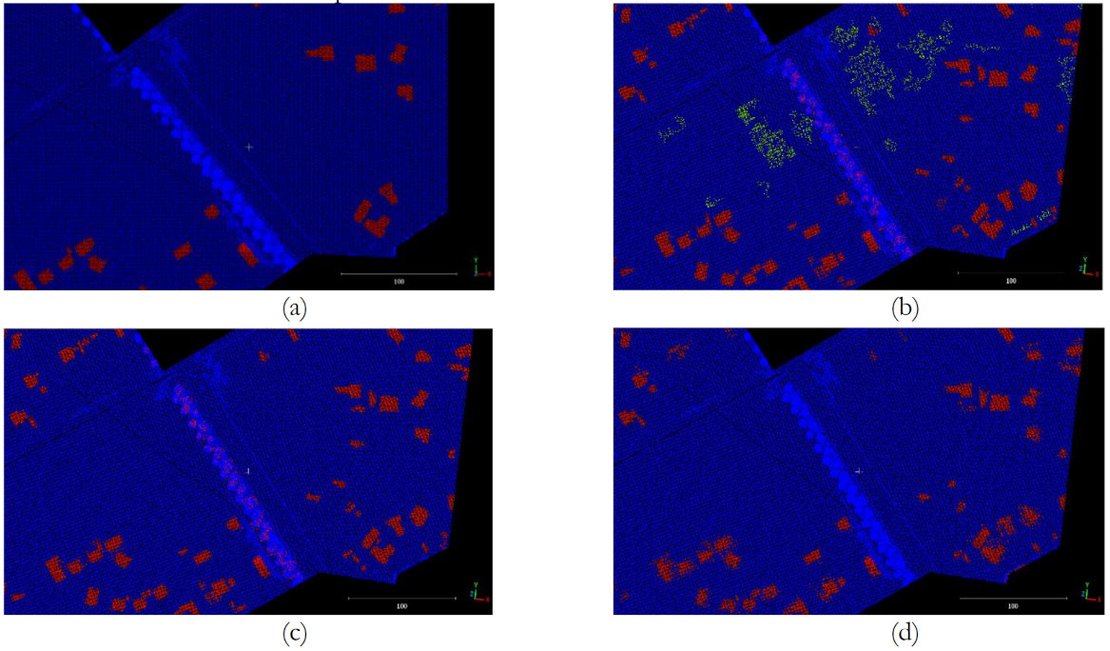
Figure 2. Prediction on an AHN tile, a) Ground truth, b) RF, c) FCNN, and d) CNN. Blue colour represents non-change, yellow/ light green represents new buildings and red represents demolition.
The primary challenge in this project was managing the vast volume of point-cloud data. Unlike images, point clouds represent three-dimensional data, allowing for multiple data points at the same location, a scenario often encountered in forested areas. The sheer volume of this data exceeded the processing capabilities of my local PC. Geospatial Computing Platform was instrumental in overcoming this hurdle by offering a robust computational environment that enabled me to test various models extensively until I achieved satisfactory results. The platform's user-friendly interface significantly enhanced my thesis work, making the research process not only more efficient but also more enjoyable. I am deeply thankful for the support Centre of Expertise in Big Geodata Science (CRIB) provided.
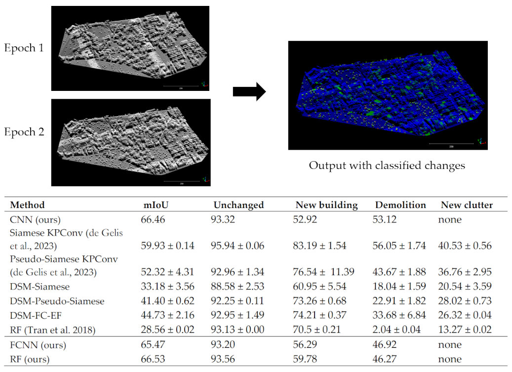
Figure 3. Visualization of the thesis product (up) and comparison of accuracies with different models (down).
In an era where data quality and volume are improving, the demand for platforms that enable researchers to test their ideas is increasing. The Geospatial Computing Platform meets this need effectively, facilitating research progress by eliminating computational delays and other non-essential obstacles. This support benefits not only the researchers but also advances the interests of the university and the broader scientific community.
For more information:
Nofulla, Jorges (2023) Deep Learning-based Change Detection and Classification for Airborne Laser Scanning Data.
GitHub repository: Point-Cloud-Urban-Change-detection