Greetings from the Big Geodata Newsletter!
Greetings from the Big Geodata Newsletter! In this issue you will find information on the European Commission's Workshop on Big Data and Artificial Intelligence for Earth Observation, UT's new Virtual Research Environment service, parallel R in nutshell, Intel Geospatial - Intel's new cloud-based geospatial analytics platform, and Atlas of Global Surface Water Dynamics with beautiful maps and images based on big data analysis! Our regular upcoming events, recent releases, and CRIB news sections are also there. We have also a short survey on big data software needs! Happy reading!
If you find the newsletter useful, please share the subscription link below. You can access the previous issues of the newsletter on our web portal.
Workshop on Big Data and AI for Earth Observation
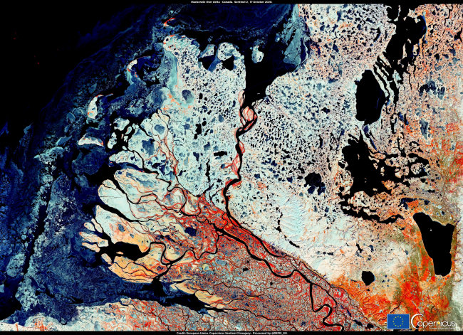
Image credits: EC, 2020
On 19-20 November, the European Commission will host an online workshop on Big Data and Artificial Intelligence for Earth Observation. Outputs of various big-data related research projects funded by the Horizon 2020 Space Programme will be presented during the workshop: the BETTER Data Pipelines, the CANDELA platform, the EOPEN platform, OpenEO's API, PerceptiveSentinel's EO-LEARN Python library. Expected outputs of several new projects will also be summarized: CALLISTO's highly interoperable Big Data platform, the DeepCube Platform for analytics and AI, GEM's AI-enhanced EO-LEARN framework and RapidAI4EO's improved AI processes and training datasets for land monitoring applications.
The workshop will be webcast live for both days and can be followed from the following streams: Day 1 - Day 2. It will be possible to ask questions through Sli.do with the event code #H2020BigDataAISpace2020. Check the agenda for this nice opportunity!
UT Virtual Research Environment
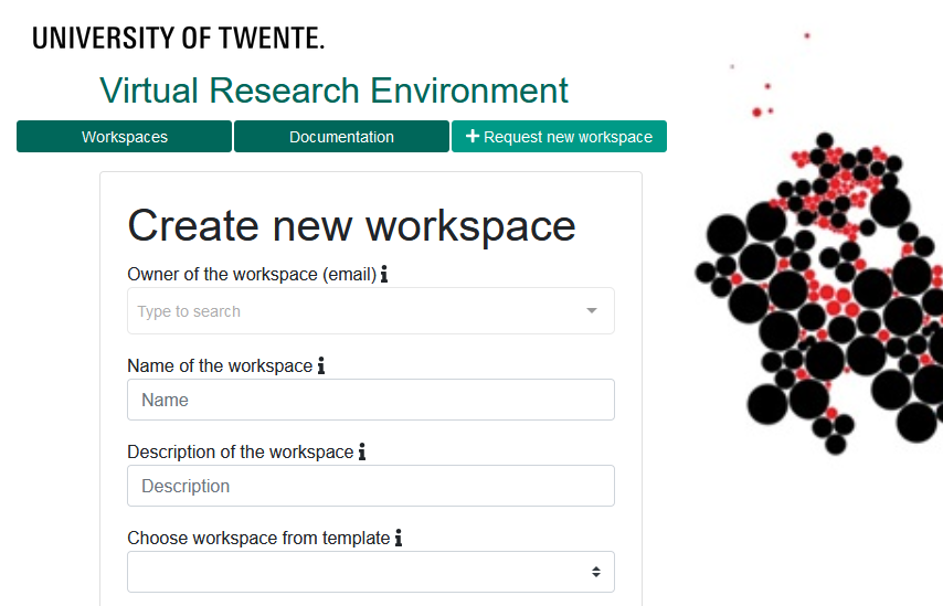
Image credits: ESA, 2020
Cloud service providers are racing to add more features to their platforms, which become more and more extensive, but complex at the same time. Especially if you are a new user, it is really challenging to set up your computing environment and some support is required at the beginning.
Considering this need, LISA in collaboration with 2at started a new service: Virtual Research Environment (VRE). VRE provides an easy-to-use interface that makes it easier to acquire, set up, and manage digital workspaces for research in the Microsoft Azure. The service is based on F-series virtual machines, which can be scaled up and down according to needs. Each machine also features ready-to-use software (e.g. Matlab, SPSS, Python, R) on Windows environment. The service is designed according to the UT budget workflow and you only need an OFI number to start using it! Check the VRE portal for more information and documentation.
Upcoming Meetings
- Big Data and Artificial Intelligence for Earth Observation Workshop (Online), 19-20/11/2020
(Agenda, Registration) - AI & Big Data Expo Europe 2020 (Online), 23-24/11/2020
(Agenda, Registration) - Dutch AI Coalition: Algorithms that Work for Everyone (Online), 24-26/11/2020
(Agenda, Registration - selected presentations in English) - IEEE BigData 2020 (Online), 10/12 - 13/12/2020
(Registration)
Parallel R in Nutshell
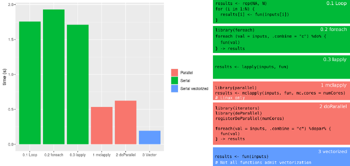
Image credits: Rodríguez-Sánchez, 2020
Nowadays our workstations and laptops (and mobile phones!) have at least 4 cores and 8 cores are becoming the new norm. Being able to perform many tasks in parallel is a great opportunity to reduce the overall execution time. However, in most cases this capability does not come out-of-the-box and requires the use of proper tools and methods. If you are an R user, "Parallel R in a Nutshell" written by eScience engineer Pablo Rodríguez-Sánchez provides a nice introduction on various possibilities!
PS: Are you a Python user? No problem, check this post instead!

Intel GEOSPATIAL
 Image credits: Intel, 2020
Considering the size of the geospatial analytics market, which is estimated to be over 96 billion USD by 2025, it is not surprising to see more big names in the field. In September, Intel launched Intel Geospatial, which is a cloud platform powered by its data centers that features analysis ready data, 3D visualisations, and analytics tools for geovisual workloads. The platform features a geospatial data lake to consolidate and enrich data, especially collected by drones, manned aircraft, LiDAR, and autonomous vehicles. Besides offering out-of-the-box algorithms for risk classification, object counting, distance measuring, and public and private record reconciliation, the platform also provides APIs for integration to the services provided by various solution partners, as well as custom development.
In their early stages platforms like Intel Geospatial are usually very open to collaborations, therefore it can be useful to explore its features and capabilities. You can watch demonstration videos or request a demo for more information.
Survey: Big Data Software & Libraries
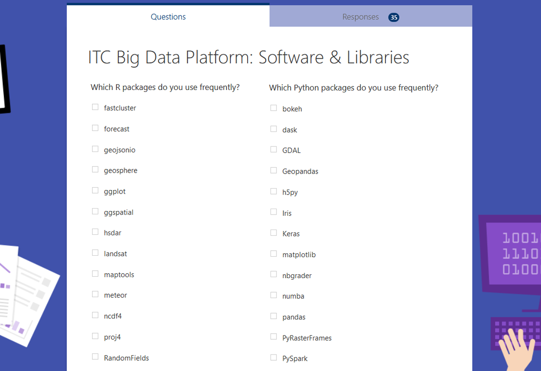 Image credits: CRIB, 2020
Our big geospatial data analysis platform is now in the testing phase! The platform, which will be open to all staff and students, provides access to a distributed storage and computing cluster backed by special NVIDIA Jetson Xavier units with GPU/TPU support. An interactive interface based on Jupyter Notebooks allows easy data analysis and visualization by using Python and R. But we can also provide more!
By indicating the software tools and packages you use frequently, you can help in shaping the default environment of the platform and ensure a service that fulfils your current and future needs. We have prepared a short survey for this purpose and circulated through our User Sound Board members. So far, we received about 40 responses. If you did not participate already, here is the link for you.
Thanks!
Recent Releases
- OpenCV: Open-source computer vision and machine learning library
4.5.0 (2020/10/12) - Kyro: Fast and efficient binary object graph serialization framework for Java
5.0.0 (2020/10/18) - Apache Ignite: Scalable fault-tolerant distributed in-memory computing platform for real-time apps
2.9.0 (2020/10/21) - OpenBLAS: Open-source optimized BLAS and LAPACK library
0.3.12 (2020/10/24)
the "Big" Picture
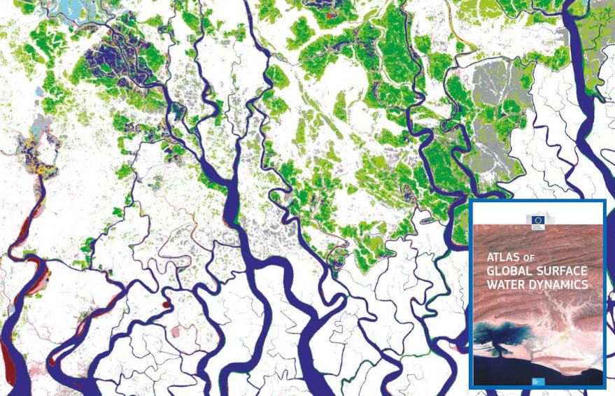
Image credits: EU, 2020
European Commission Joint Research Centre and Google collaboration on global surface water mapping is a well-known big EO data analysis success story. More than 4 million Landsat 5, 7, and 8 images were analysed on Google Earth Engine to determine spatial and temporal distribution of surface water in the last 35 years. The resulting data set is publicly available for download or further analysis, and can be explored through a dedicated web application. If you are interested in a more visual history of water, then there is a new option available: Atlas of Global Surface Water Dynamics. The atlas provides a journey through some of the most fascinating examples of surface water changes through a series of beautiful maps, images, and case studies. It's definitely worth to have a look!
Belward, A., Pekel, J., Cottam, A., Gorelick, N., De Felice, L., Wen, Q. and Dewsbery, I., Atlas of Global Surface Water Dynamics, Publications Office of the European Union, Luxembourg, 2020, ISBN 978-92-76-16299-5 (online),978-92-76-16298-8 (print), JRC119892, doi:10.2760/20986

