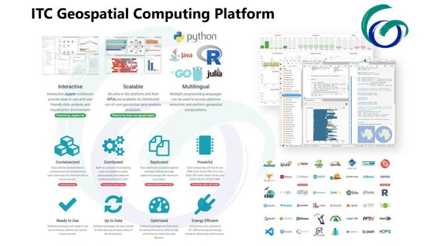
ITC Geospatial Computing Platform has been operational since January 2021 and provides a user-friendly cloud-based interactive interface for data analysis and visualisation with hundreds of ready-to-use scientific and geospatial analysis software packages, including desktop applications (e.g. QGIS, R Studio).
This short online training workshop aims to provide in-depth information on the architecture, capabilities, and limitations of the Geospatial Computing Platform (https://platform.crib.utwente.nl). Available computing resources and core platform components are explained. Interactive notebook, terminal, and remote desktop interfaces are demonstrated with different use cases. Best practices for data management and research environment customization (e.g. installing new software packages) are described. Services integrated to the platform (e.g. PostgreSQL, Geoserver) are explained and demonstrated.
At the end of the training, you will have a better understanding on how the platform works and how you can use its capabilities for education, research, and capacity development activities.
Prerequisites: None
Instructor: dr. ing. Serkan Girgin MSc (s.girgin@utwente.nl)
Date: 18 May, 13:30 - 15:30 (Session I), 20 May, 13:30 - 15:30 (Session II)