harnessing the power of technology to automate the analysis and interpretation of large and complex spatial datasets—like satellite images, UAV data, and local sensor data
Geospatial artificial intelligence (GeoAI) is an exciting fusion of innovations in spatial science (GIScience) and big geospatial data with the rapid growth of methods in AI and machine learning helping us to increase our understanding of earth processes and support the development of solutions to better manage earth’s resources and ecosystems, improve our living environment and for example assess disaster risks. If you’re passionate about harnessing the power of technology to automate the analysis and interpretation of large and complex spatial datasets integrating, for example, remote sensing images, UAV data, citizen science and local sensor data, then GeoAI is the perfect theme for you.
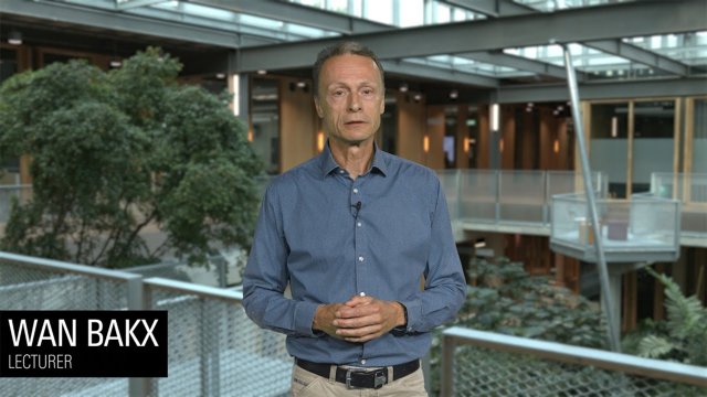
Video GeoAI explained
In this video, course coordinator Wan Bakx explains the Geospatial Artificial Intelligence (GeoAI) specialisation within the Master's in Geo-information Science and Earth Observation.
Master's Geo-Information Science and Earth Observation
This specialisation is for tech-savvy creative enthusiasts who would like to exploit the almost endless opportunities of AI to help make the world a better place.
Wan Bakx
Earth Observation without Remote Sensing is like building an IKEA closet without the instruction; you don’t get what you want.
Wan Bakx
What is GeoAI?
The abundance of geospatial data, advanced remote sensing and GIS technologies, machine and deep learning algorithms and the wide variety and scales of geospatial problems require specialists and scientists with specific academic and technical skills. The GeoAI specialisation offers ample opportunity to develop the necessary skills that will enable you to leverage the latest technologies, like the application of drones/UAV and cloud computing, and algorithms like machine learning. The focus of this specialisation is on building a solid understanding of the suitability of machine and deep learning algorithms for specific geospatial problems using available big complex geospatial data sets that come from various sources, including citizen science, survey, GPS or satellite images. It comes without surprise that you develop appropriate scripting and programming skills to exploit and improve existing algorithms. In the end, you ensure that the generated geo-information is reliable and actionable.
Learning pathways
Under this specialisation, two predefined pathways exist. These pathways offer a coherent set of courses directed at a certain career path. Probably one of the available pathways in the programme will suit your needs. You can tailor some of the courses and choices in these pathways, but you should discuss this first with your mentor or study adviser.
As a Remote Sensing Specialist, you have extensive knowledge and skills on a wide variety of Remote Sensing sensors, and you understand the operational behaviour, limitations and capabilities of the platforms carrying them. You have an interest in the technology and how to advance its application for global challenges. This means you can cover the whole range from satellite remote sensing, through aerial survey, down to drones/UAVs using, for example, optical (multispectral and hyperspectral sensors), radar or LiDAR sensors. It is not only vital to understand how to acquire relevant data but also to understand how to integrate the variety of data types and sources to support solving important, critical environmental and societal challenges related to urban expansion, food security, disaster management, or climate change.
You will explore and understand algorithms ranging from traditional machine learning, like Random Forest and Support Vector Machine, to cutting-edge deep learning, such as Convolutional Neural Networks or Transformer Networks. We emphasise the appropriate application of these machine and deep learning algorithms, e.g., to map changing glacier patterns, classify and monitor crops, study the spatiotemporal variations of nutrients in crop grains, but also efficiently and accurately model 3D building and infrastructure for urban expansion modelling and flood assessment and prediction. There is a wide range of applications in which you can contribute with your versatile technical knowledge and competencies in Remote Sensing.
Data has become vital for governments, public organisations, and businesses to remain competitive, realise their aims, or fulfil legal mandates. Much of this data is geospatial and enables a wide range of applications.
As a Geospatial Data engineer and scientist, you are responsible not only for building data infrastructures, integrating data from multiple sources, and enriching data to access relevant information, but also for (systems) modelling and analysing spatial and temporal data. You will help study, understand and address human and environmental problems, thereby contributing to a more sustainable and digitally fairer world. As part of your tasks, you contribute to developing geodata-intensive solutions, requiring you to translate scientific and technical questions from colleagues, management, or customers into data and information products. You can visualise and communicate analytical outcomes appropriately. You have a high level of conceptual thinking and a critical attitude when translating information needs into geospatial products and solutions. You can work with big data in the cloud or in a distributed fashion to perform and automate specialised tasks using coding. As an expert in using up-to-date analytical and artificial intelligence techniques, methods and tools, you can reveal new patterns and insights from heterogeneous data sources.
In short, you will contribute to the advancement of knowledge and technology by delivering actionable spatiotemporal information or information systems.
What will you learn?
As a graduate of the Master's in Geo-Information Science and Earth Observation with a specialisation in GeoAI you have acquired specific, scientific knowledge, skills and values.
After completing this Master’s specialisation, you will:
Comprehensive understanding of methods and technologies to acquire and integrate geospatial data at multiple scales and from multiple sources, including remote sensing, and store it efficiently
In-depth knowledge of state-of-the-art quantitative machine learning methods for analysing big and complex geospatial data sets and generating actionable information and knowledge to achieve sustainable development goals
After successfully finishing this Master’s specialisation, you are able to:
Develop systems to capture, generate, process, and share various geospatial data and information according to established international standards
Develop and train new and existing algorithms and machine learning models for analysing various geospatial data
Develop methods to model complex systems exploiting big geospatial datasets, and generate reliable predictions and classifications
Develop scripts and programs to exploit and improve existing algorithms
Document and share your work transparently and reproducibly following best practices of open science and explainable AI research
After completing this Master’s specialisation, you:
Strive for and are capable of objective, independent, and critical thinking
Have developed a strong interest in responding to changing demands and opportunities from society and industry, both in scientific and technical terms
Embrace the value of open and reproducible science (data, programs, solutions)
Value geo-information and earth observation data for providing solutions to global challenges and sustainable development goals
Take a professional, responsible, and ethical approach to working with GeoAI, stakeholders and clients
Other master's and specialisations
Is this specialisation not exactly what you are looking for? Maybe one of the other specialisations suits you better. You can also find out more about related Master’s at the University of Twente:
Choose your specialisation during the first quartile
Can't decide which specialisation is right for you? You don't have to make a decision now. You can choose your specialisation during the first quartile of the programme.